


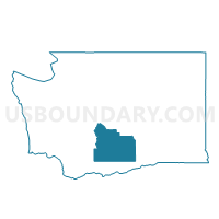
Zillah Voting District, Yakima County, Washington
About
Outline

Summary
| Unique Area Identifier | 690206 |
| Name | Zillah Voting District |
| County | Yakima County |
| State | Washington |
| Area (square miles) | 1.78 |
| Land Area (square miles) | 1.78 |
| Water Area (square miles) | 0.00 |
| % of Land Area | 100.00 |
| % of Water Area | 0.00 |
| Latitude of the Internal Point | 46.40850220 |
| Longtitude of the Internal Point | -120.27374480 |
Maps


Graphs
Select a template below for downloading or customizing gragh for Zillah Voting District, Yakima County, Washington


Neighbors
Neighoring Voting District (by Name) Neighboring Voting District on the Map
- Buena Voting District, Yakima County, WA
- E Toppenish Voting District, Yakima County, WA
- E Zillah Voting District, Yakima County, WA